We headed out to Black Canyon of the Gunnison North Rim, via Hwy 92 from the Blue Mesa Dam. Below Blue Mesa Reservoir is Morrow Point Reservoir, then Crystal Reservoir, each with their own dam. Morrow Point appears to be a river within the black canyon, below.
The story of the narrow gauge railroad in the Black Canyon is very interesting...

A view across Morrow Point reservoir with the San Juan Mountains in the background to the south; this is the same mountain range we viewed from the other side while in Lake City area.


The scenery up the 92 towards the north rim is spectacular; wildflowers everywhere. Crawford Reservoir and the West Elk mountains in the background to the east.


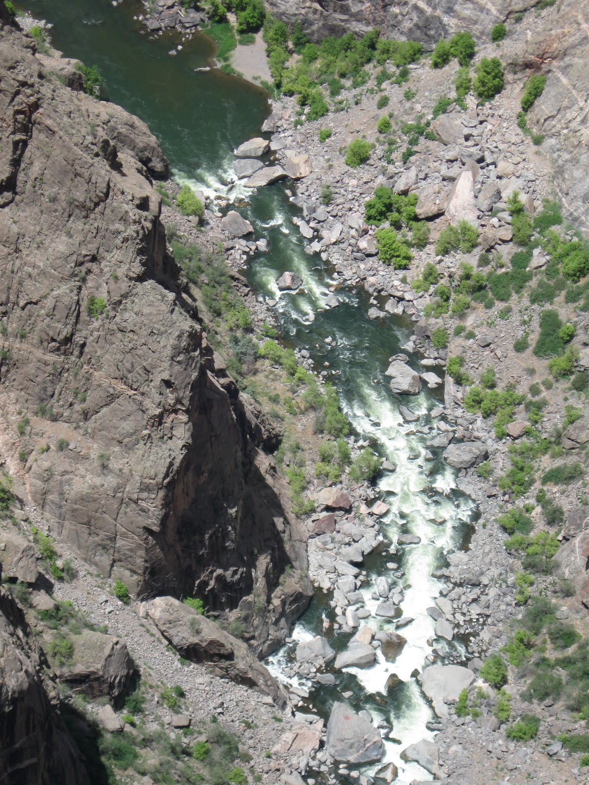
Below are various views of Black Canyon of the Gunnison, as seen from the North Rim. This is our nation's newest national park, which gained that status in Oct 1999 (previously a national monument). This hard dark crystalline rock is nearly 2 billion years old - some of the oldest exposed rock on earth.
The total length of the canyon is 53 miles, only 14 of which are in the national park. It's not the deepest canyon in North America, but is impressive nonetheless! click HERE for dimensions and comparisons of this canyon to others
The river used to be many times stronger, before the dams were built upriver. It drops an average of 43 ft per mile through this canyon, and within the national park, averages 96 ft/mile and reaches 240 ft/mile in the narrows, as compared with the Colorado River which drops an average of 7.5 ft per mile through the Grand Canyon. The Gunnison drops over 4600 feet in a 48 mile stretch, farther than the Mississippi falls over its entire 1500 miles. So, it goes without saying, the black canyon is not kayak friendly. In fact, the national park website suggests that, when the river is at its strongest, "death is probable". Hmph. Think I'll skip this one.
There were signs at all the overlooks, warning to not throw rocks as there may be hikers below. I can't imagine how; the canyon walls are so incredibly sheer in most places! There are no maintained or marked trails in the inner canyon, and you can see why.
This very first shot is the "Painted Wall", which is the tallest vertical wall in Colorado, at 2,250 ft. For advanced rock climbers only.


We headed back "home" via a loop through Crawford (great reservoir and view of the mountains), Hotchkiss (loved this little town, lots of interesting stops - restaurants, shops), and through lush green farmlands to Delta (I have a whole collection of pictures of their town murals!), and Montrose.
It was a very long day!
1 comment:
Dear Mary and Gary,
just wanted to let you know how excited I am to have found your blog. I am from Germany and currently researching for my trip to Colorado next year. My boyfriend and I are planing on renting a small RV. This has been my dream for a very long time. So reading about your travel and seeing those pictures is just great. Thought I'd let you know that your blog is very appreciated in Germany :-) Tanja
Post a Comment